HOW TO GET TO MOAB:

Fly into Moab Canyonlands Field. About 20 minutes south of the airport on Hwy 191.

Fly into Grand Junction. About two hours away. Take I-70 west to 191 South, exit, about 30 minutes to Moab.

Fly into Salt Lake City. Which is about a four hour drive to Moab. Take I-15 south to Hwy 6 through Price to I-70. Turn left (east) on I-70 at Green River and take Hwy 191 South into Moab.

TRANSPORTATION TO BASE CAMP FROM MOAB:

Drive to Moab. The road normally doesn’t need four wheel drive but all wheel drive or four wheel drive increases your odds. Jeep, truck, and most SUVs are best. In most cases I wouldn’t drive anything with less than six inches of ground clearance. Anything less than that will likely cause occasional inappropriate relationships between the bottom of your vehicle and Mother Earth.

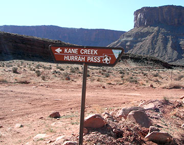
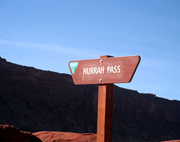
Call Twisted Jeep rentals in Moab. 435-259-0335. Jeep trails in Moab are rated from easy one to ten more difficult. The road to here is a one. They know that somebody might rent their Jeep and do a four or a six where their vehicle is more likely to sustain damage. You tell them you’re coming to Base Camp, they know the easy rating of the road and their vehicle won’t take much abuse. If they’re not almost sold out already they’d rather rent to you going on a trail rated easy than a more difficult one so if they can give you a deal they will. Make sure you tell them you’re going to Base Camp.

Uber has a lady, Kathy, that will bring you out here in her truck for $150 each way. She knows the road well and is good people. Kathy’s number is 435-215-1669.

DIRECTIONS TO BASE CAMP FROM MOAB:

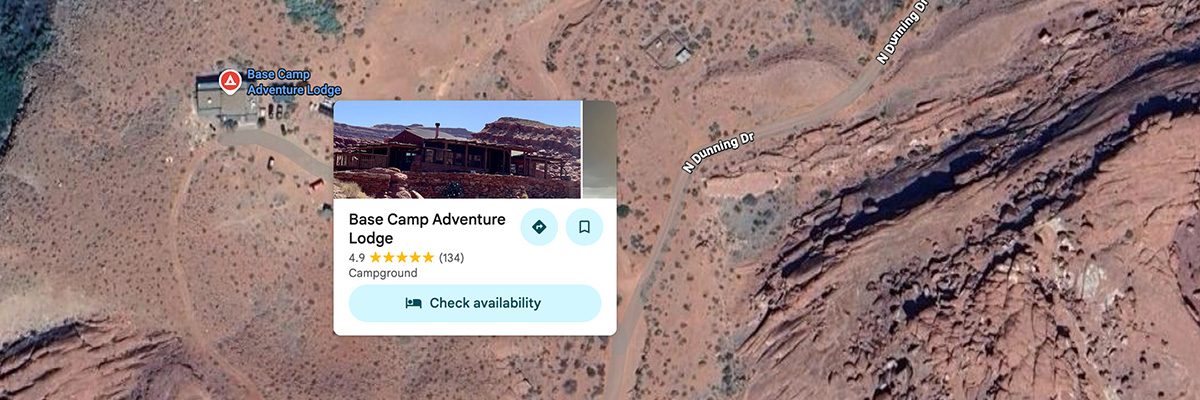
Lodge GPS is: 38.474098, -109.65393
We are channel 35.

  • Route 191 go west between the side by side rental shop and McDonalds, turn on “Kane Creek Blvd”. Sometimes spelled "Cane Creek Blvd"
  • At the Y in the road and the stop sign, STAY STRAIGHT, and the Colorado River will be on your right side.
  • After 4 miles of paved road it will turn into a hard packed dirt road- RESET YOUR ODOMETER NOW- You'll wind through the canyon and then into a valley area.
  • You will cross over Hunter Creek which has a bridge over it.
  • Six miles after you've left the pavement you will cross Kane Creek which if it has water in it go all the way to the right.
  • At approximately 6.3 miles from where you left the paved road you will see the “Hurrah Pass” sign shortly after you cross Kane Creek. Then the road splits solidly. Take the main road which veers to the right.
  • You will go 2.7 miles from this point to the top of "Hurrah Pass" and in most cases best to swing wide on the corners. As you crest Hurrah Pass make sure you find the Hurrah Pass sign on your left and the road down Hurrah Pass is about ten feet to the right of the sign.
  • At the top of "Hurrah Pass" depending on your cell phone provider in most cases you should have cell service. You will be able to see the roof of Base Camp directly in front of you, just this side of the narrowest part of the river. The top of Hurrah is where guests frequently meet do gooders telling you there’s nothing down the other side and you’ll never make it. Please ignore. You already made it to the top. If you have a walkie talkie we are channel 35. This will likely be the last time your cell phone works until you get to the lodge and use wifi. We have Star Link wifi with no password so it should pick you up and give you wifi as you come up the driveway. If not just click on Star Link.
  • From the top of Hurrah down the west side is exactly 2.3 miles to the Base Camp sign. YOU MUST TURN RIGHT AT THE SIGN. Go down the hill and through the creek bed and we are the first left hand turn.
  • You will see a parking area on the left and WELCOME!!!